Geophysical studies focused on imaging of the lithosphere
We use mainly potential methods like gravity and airborne magnetic data in order to examine deep structure of studied orogenic systems. These studies allow for characterization of vertical and horizontal heterogeneity of collisional and accretionary orogenic systems and the method was successfully used to characterize nature and structure of orogenic lower crust in the Variscan orogen, Mongolian and Chinese tract of the CAOB. Paleomagnetic studies of oroclinal bending in the European Variscides and Mongolian CAOB are also important.
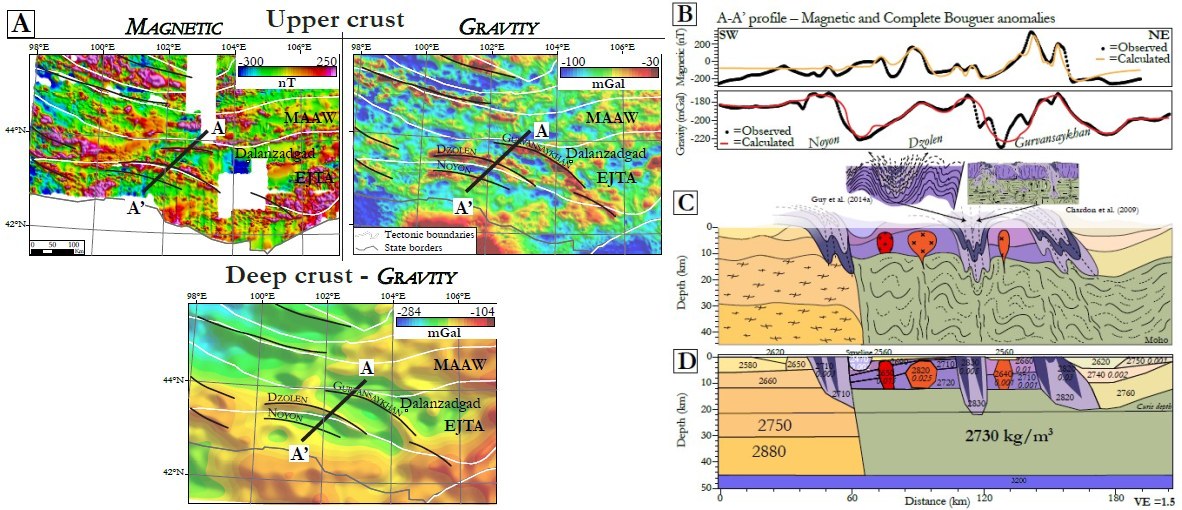
2D forward model for southern Mongolia. A. Magnetic and isostatic residual gravity and long-wavelength complete Bouguer depth sliced (source layer at 39 km) anomaly maps to visualize the trends of the upper and deep crustal signals. The thick black curves underline the global trend of magnetic and gravity highs. The white lines represent the tectonic boundaries. The gray line is the state border. B. Observed and calculated magnetic and gravity data. C. Simplified geological cross-section along the profile A-A’. D. Global structure of the crust in southern Mongolia from magnetic and gravity forward modeling profile. Unit of density = kg/m3; unit of susceptibility=SI. [link]